State College PA
Route 322
Reply
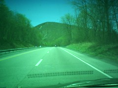
I’m heading out on a trip to help my friend move to Oregon, here’s my route. Wish me luck….
Updated trail map for the Conestoga Trail System:
PDF Version: 070420-cts_vector_map.pdf
Google Earth Format: ConestogaTrailSystem070420.kml
New Pics!
Images from my third day on the trai, part of my project to update the trail maps for the Conestoga Trail System. It was a gorgeous day: mid 60s and cloudless blue skies. Winds in the 5 – 12 mph range. I got in about 8 miles and then had my wife and kids pick me up for the return trip to the truck. That sure is a better way to do things instead of backtracking. Click on the pic to the left for the Gallery.
Trail Report:
The trail seems to be in fair condition, but is soggy in a lot of places. That’s to be expected along a creek bed in early Spring–we have had a bunch of rain in the past 2 weeks. Look out for electric fences! In this stretch there are several of them that you have to cross under/over as you make your way through the fields. Also, cows and horses leave behind some big piles of stuff, so tread carefully. Continue reading
GPS TrackMaker
– Most complete free program for GPS devices
– Compatible with more than 160 GPS models
– Support for Garmin, Magellan and others
– Easily create your own maps
– Support for vector maps and images
– Multi-Language
– Vehicle Tracking and AVL
– Completely free. No Adware, Spyware, …
A.T. Essentials – Appalachian Trail Conservancy
In 1921, the Appalachian National Scenic Trail was simply an idea. Benton MacKaye – an off-and-on federal employee, educated as a forester and self-trained as a planner – proposed it as the connecting thread of “a project in regional planning.”
The efforts of countless volunteers made MacKaye’s idea a reality. Today, the Appalachian Trail is best known as a simple footpath, yet it also has other identities – as a greenway, a flyway, a “mega-transect”; by which to monitor environmental health. It is the mission of the Appalachian Trail Conservancy to ensure that future generations will enjoy clean air and water, scenic vistas, wildlife and opportunities for simple recreation and renewal along the entire Trail corridor.
The Real Mason Dixon Trail Website
The Mason Dixon Trail connects the Appalachian Trail with the Brandywine Trail. This 190-mile long trail starts at Whiskey Springs, on the Appalachian Trail, in Cumberland County, PA and heads east towards the Susquehanna River, passing through Pinchot State Park en route. The trail then follows the west bank of the Susquehanna south to Havre de Grace in Maryland. Across the river, the M-DT continues east, passes through Elk Neck State Forest, then on to Iron Hill Park in Delaware, north along the Christina River and White Clay Creek to the White Clay Creek Preserve. The trail then heads northeast to its eastern terminus at Chadds Ford, PA on the banks of the Brandywine River.
The Horse-Shoe Trail is a 140-mile hiking and equestrian trail that runs from Valley Forge to the Appalachian Trail in southeastern Pennsylvania.